
Tracing an Odessa Street Directory
Ownership, location, and occupancy are different facts. An Odessa street directory workflow can identify the parcel tied to an address, the owner shown on an appraisal account, recorded parties in a deed trail, a related legal description, and a dated published address. It cannot turn those separate records into a current household list. Keep the original address spelling, direction, suffix, unit, ZIP, and any historic form. An address that appears in just one system is a lead that needs another source, not a confirmed identity.
- Run the address through USPS to standardize its current street, city, state, unit, and ZIP presentation.
- Search Ector CAD by address and save the account number, situs, mailing address, owner as displayed, and legal description separately.
- Use the CAD map or County Web Map Portal to view parcel context and follow the account link to details.
- Search the County Clerk land index with the displayed owner, subdivision, lot, block, survey, abstract, or approximate date.
- For an earlier period, compare a dated telephone directory, city directory, Sanborn sheet, microfilm reel, or City Archive result.
The record trail is best read one dated link at a time: address to CAD account, account to legal description, legal description or owner to recorded instrument, then an older dated source. A new fact should be tied to a source before it is carried to the prior era.
Normalizing Odessa Street Directory Addresses
USPS ZIP Code Lookup has By Address, By City and State, and Cities by ZIP tabs. The address form requires street, city, and state, while company, unit, and ZIP can be optional. Preserve the original wording from a deed, directory, or map as well as the current standardized form. North versus N, East versus E, and suffix variations can affect an address search. The Ector CAD address screen similarly accepts an optional number and direction, a required full or partial street name, and an optional suffix.
USPS says an address result does not confirm that a person or company is associated with that location. It verifies a delivery-oriented address result. Odessa's postal codes range from 79760 through 79769, but USPS operational groupings are not neighborhood boundaries and do not establish a municipal or county boundary for a parcel. A 2014 Postal Bulletin reassigned 79762 and 79768 from an Odessa 79765 grouping to 79762, so a historic ZIP can differ without the street moving.
Odessa Street Search Fields
Ector CAD's address route is a strong official tool for browsing a street. The owner-name search uses a required last name and optional first name, each full or partial. The advanced parcel screen adds owner name, street-number range, street name, city, subdivision, neighborhood, parcel controls, tax district, property use, zone, square-footage ranges, acreage, original construction year, and a sort field. Its absence of a ZIP filter is a local quirk, so start with the actual street fields rather than trying to make a postal label do the same work.
| Ector CAD route | Field type and requirement | Street-directory use |
|---|---|---|
| Address | Number and direction optional; street text required; suffix optional | Search a full or partial street when the number is uncertain |
| Owner name | Last name required; first name optional; both permit partial entry | Return to a parcel after a recorded name is found |
| Advanced parcel | Optional range, street, city, subdivision, neighborhood, parcel, district, use, zone, area, acreage, year | Narrow a street-wide result by parcel characteristics |
| Map | Property ID, address, or owner text | Confirm map context, click a parcel, and reach CAD details |
CAD reports appraisal and tax information. Its owner mailing address and property situs should be copied into separate notes because a tax correspondence address may be outside Odessa or may belong to an agent, estate, business, or prior owner.
Odessa Address Record Terms
Street research crosses systems that use different words for the same physical area. Recording each label reduces bad matches, especially when a document has no street address or an older source uses a former form. These definitions describe the field, not a person's current connection to it.
- Parcel
- A CAD-mapped property unit tied to an account and often to a legal description.
- Situs address
- The appraised location of a parcel. It is distinct from an owner's tax mailing address.
- Plat
- A recorded map that can show a subdivision, lots, blocks, streets, or dedications.
- Legal description
- Land wording such as subdivision, lot, block, survey, abstract, tract, or metes and bounds that may replace a street address in a deed.
- Criss-cross directory
- An address-arranged historical directory, if a collection holds one, used to locate published entries by street.
Odessa Streets on the CAD Map
The Ector CAD map searches by property ID, address, or owner and supplies Search and Details controls. County map instructions describe search categories for account number, owner, address, and legal description. A click on a parcel can show its context, and the account number links back to Ector CAD. Save the map date and account link with any result. The research inspection did not capture a live adjacent-parcel result, so a visible map position should not be described as more than parcel context.
A block on the map can help distinguish similarly named streets, follow an adjoining legal description, or compare a directory address with a current parcel. Physical adjacency does not establish any personal relationship between owners or occupants. Ector CAD also cautions that tax values are preliminary and should not be mistaken for title proof or evidence of occupancy.
Odessa Street Deed and Plat Trail
The Ector County Clerk is the recorder for land records. The official Tyler portal presents itself as a public index and warns that the index is not a certified title opinion. Its exact live fields and image behavior were not independently captured during research, so confirm them directly before relying on a feature. The county-linked TexasFile interface documents a useful parallel search grammar: Full Name 1 and 2 with role selectors, instrument number, book and page, legal-description fields, reference text, and start and end dates.
The Ector County Clerk index interface on TexasFile shows the grantor, grantee, instrument, legal, reference, and date controls used to follow a recorded address trail.
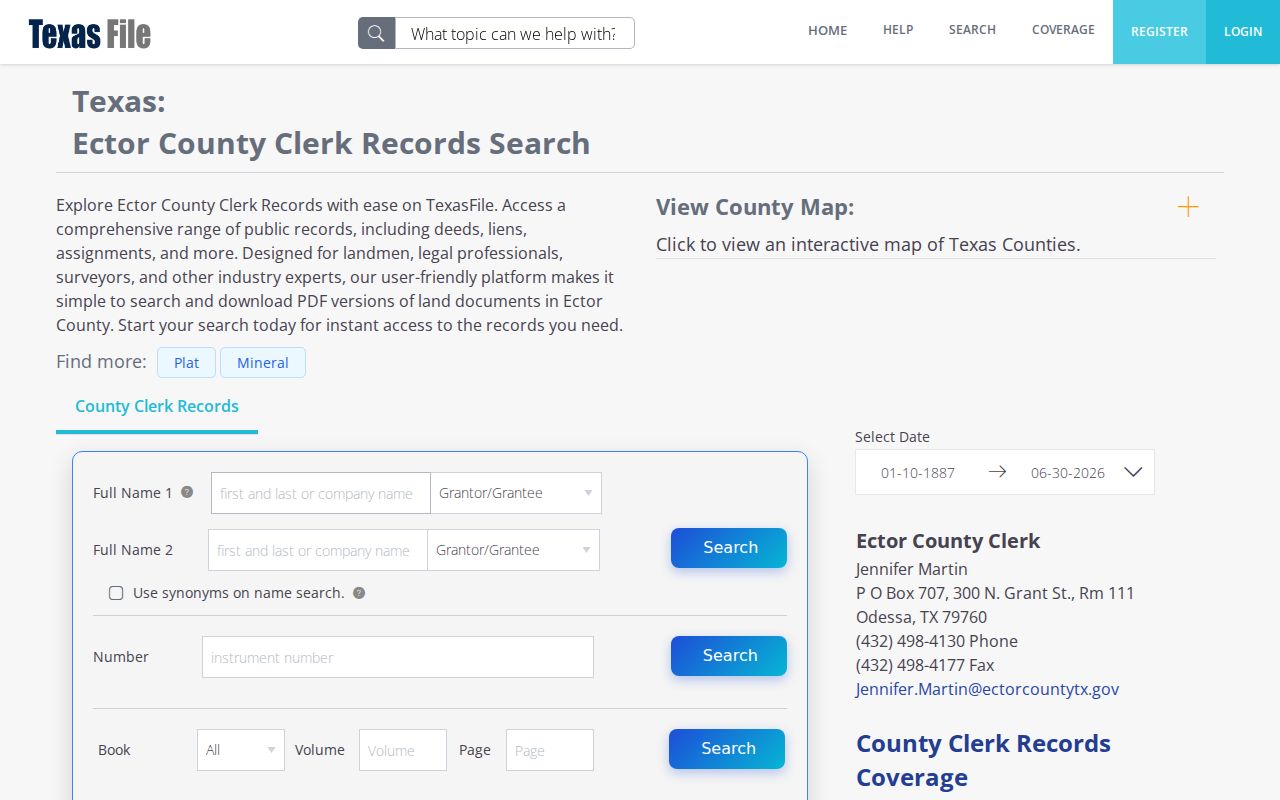
Use a CAD legal description to move from a street address into a deed or plat search. An index line can identify a recorded party, document type, date, legal description, and reference number. It does not establish a current resident or replace review of the actual instrument. The vendor displayed full-index coverage from January 10, 1887 through June 30, 2026 and plat coverage from January 1, 1900 through December 30, 2025; confirm coverage and copy charges with the Clerk.
City GIS Around an Odessa Street
City of Odessa GIS adds municipal context that is separate from the CAD parcel database. Its public gallery includes maps for plats, voting districts, planning, flood zones, solid-waste schedules, fire hydrants, parks, and related layers. Use it to identify the kind and date of the layer being viewed. A planning or flood layer can explain a public geography question around a street, but it should not be treated as a deed record or a list of people.
City of Odessa Geointelligence GIS links to the public map gallery.
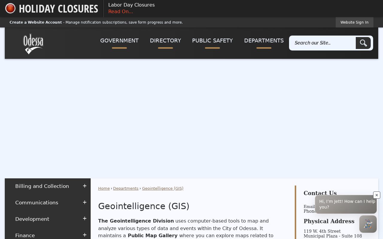
GIS staff are listed at 119 W 4th Street, Suite 108. The inspected city page did not expose a single official address-history database, current neighborhood boundary file, or a live adjacent-parcel example. Preserve the map's title and date instead of inferring an unavailable layer.
Odessa Street Directory Record Coverage
Address-keyed records can be chained, but each row below has a separate custodian and limit. Parcel details lead to an account and legal description. Recorded instruments can supply parties and a land trail. City tools can document public actions tied to an address. Election and published-directory materials are governed by their own disclosure and date limits. A street directory result becomes more reliable when the record type and date are stated alongside it.
| Address-keyed source | Keeper | What it can show | Access or limit |
|---|---|---|---|
| CAD property record | Ector County Appraisal District | Account, owner as displayed, situs, mailing address, legal description, values | Public rolling appraisal and tax data; not occupancy or title proof |
| CAD and county map | Ector CAD and Ector County | Parcel context, account link, address, owner, legal search paths | Current map context; historical-layer start not located |
| Deed and plat index | Ector County Clerk | Recorded parties, type, date, instrument, and legal description | Public index route; copies and image access vary |
| City GIS and archive | City of Odessa | Public map layers, archive categories, notices, projects, and civic records | Layer and archive dates must be saved with the result |
| Historical directories and maps | Library, UT catalog, TSLAC, and map collections | Dated published address snapshots and built-environment context | Collection, year, page, and access method vary |
Odessa Voter Records by Address
An election record is not a universal street directory. Texas treats Social Security numbers, driver-license numbers, and state-identification numbers as confidential in voter material. Protected voters and Address Confidentiality Program participants can have additional suppression. Ector's voter request form warns that voter information may not be used in advertising or to promote commercial products or services. A protected or absent result is an access boundary, not an invitation to search around it.
For a lawful Ector Elections request, describe the existing voter-history or registered-voter file, county or district scope, relevant election or date, format, and contact information. The January 2022 form says requests may be available within 10 working days depending on workload and open-records rules, and it lists a 50 percent deposit for requests over $50. Verify all prices and forms with Elections because they can change.
Odessa Street Directory History
When a modern parcel and an older directory do not match cleanly, use the legal description and date to bridge them. A subdivision plat, dedication, replat, easement, or street widening can change the description without creating a wholly new physical site. For Odessa, compare documented 1927 and 1950 Sanborn coverage with the 1930 Southwestern Bell issue, later telephone directories, and Lloyd's city directories from 1955, 1966, and 1967. Record the publication or map date and whether a source is a white-pages, yellow-pages, city-directory, or map record.
The Ector County Library's Southwest History and Genealogy department has a local clipping file and staff guidance, but its public page does not publish exact reverse-directory or criss-cross runs. UT Austin's catalog also lists 1981 and 1982 Johnson directories, the 1986 Cole directory, a 2001 business directory, later AT&T records, and regional Permian Basin telephone and oil-field directories. A regional publication may provide useful context, but it is not a complete Odessa household roll.
Odessa Address Records Requests
Texas Public Information Act requests should ask for existing records, not a new answer to who lived at an address. A focused request can name the department, record category, date range, street address, permit or case number, and preferred electronic format. For example, existing inspection reports, notices, photographs, and final disposition records can be requested for a known permit or code case, subject to lawful redaction. The City archive also has keyword, archive-category, time-period, and date-range fields that can narrow a public-action search.
Building Inspection and Permits covers plan reviews, inspections, permits, and unsafe conditions. Development links to MGO Connect for workflow, document uploads, status, comments, and inspections, but the research did not expose its exact public search fields. Code Enforcement's categories describe a municipal complaint or request process, not a finding about a person. Save the case or permit identifier and final disposition before drawing any conclusion.
Limits of an Odessa Street Directory
No address search creates a complete resident list. CAD gives a tax-account relationship and separates the parcel's situs from a mailing address. A deed index records parties to an instrument. A directory captures published information for its edition date. USPS validates delivery-oriented address information, not who is at the address. Motor-vehicle information is restricted by the Driver's Privacy Protection Act, and Texas privacy rules can protect voter, vital, court, and other fields. Treat a no-result, a suppressed result, or a date gap as a documented limitation.
Lawful use. Odessa street and address records support defined personal, civic, historical, and other lawful research. Do not publish a protected address, repeatedly contact anyone found in a record, or use data to intimidate, stalk, or harass. Texas Penal Code sections 42.07 and 42.072 address harassment and stalking.